
Reach-Scale Planning

One size does not fit all
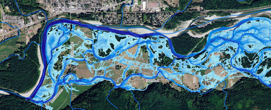
The Sustainable Lands Strategy (SLS) has identified four major river reaches in Snohomish County on which to focus its multi-benefit planning approach. The consensus amongst those involved is that a one-size-fits-all approach will not work in every part of Snohomish County. Therefore, each reach has its own plan to address its unique needs and priorities.
Each river reach contains both important salmon habitat and prime farmland and experiences periodic flooding. These reach-scale plans provide an assessment of the relevant factors that influence that ecosystem and proposes a coordinated package of strategies, actions, and projects that will provide benefit to local agricultural operations, fish habitat, and flood storage.
Reach-scale Plan Summary Brochure
Plans have been developed for the following river reaches:
By focusing on the reach as a whole and stressing mutual benefits, the SLS can achieve long-term agreement on the fish and farm net gains needed by the participants in a larger, regional picture.
To learn more about the importance of reach scale planning, using the Skykomish River as an example, see Living Within the River’s Reach.
To learn more about the North Fork Stillaguamish River, view the North Fork Stilly Story.
For an interactive guide to the landscape of the four reach-scale plan areas, see the interactive web map created by Snohomish County.